
Relatively Scottish has always been very interested in the family histories of those who lived on the Buccleuch Estates sometime in the last 300 years. I think that old maps are an important means of helping to understand the lives of our ancestors.
Those of you with an interest in historical maps of the Buccleuch/Queensberry Estates in Nithsdale may be aware that there’s an excellent collection of such maps on a farm by farm basis available online at the National Library of Scotland website (maps.nls.uk). These cover both 18th and 19th centuries and are a great insight into how our ancestors may have farmed the land.
Unfortunately though, the NLS collection doesn’t cover all the farms of the Border Estates of Roxburghshire, Eastern Dumfriesshire and Selkirkshire. There is however an alternative resource available online called Charting the Nation: Maps of Scotland and Associated Archives 1550-1740. The University of Edinburgh put this collection together back in 2014. Amongst thousands of high quality map images are individual farm maps of all Buccleuch farms which were surveyed back in 1718 as part of an extensive programme of agricultural improvement.
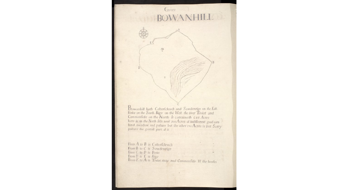
The example image above shows the map of the farm of Bowanhill at Teviothead in Roxburghshire. This shows the shape of the whole farm including buildings, rivers and enclosures where appropriate. It names all the bordering properties and offers a withering verdict on the quality of the land in many cases. Here we have ‘indifferent good corn land’ and ‘sorry pasture’.
These maps are all part of the Buccleuch Muniments kept at the National Records of Scotland. But here they are conveniently available to a worldwide audience through the University of Edinburgh website. Explore them yourself at Charting the Nation. Select ‘Browse All’ to view the full collection. Please comment if you find them useful at all.
I see what you mean! The land my ancestors worked, Mosstower, says: 60 Acres of indifferent good land but the other 120 Acres is most of it sorry land, some of it dry and stony and some very wet and boggie and the good and bad intermixed one with the other.” Perhaps this is part of the reason why he ended up in the parish poor list! I also like that it describes the various landowners.
наркологическая клиника наркологическая клиника .